ORTOVOX ALPINE TOURING APP alternatives
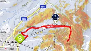
ORTOVOX ALPINE TOURING APP has the largest collection of topographical maps, alpine tools, and many cool features to help you with mountain sports. The outdoor topographic map can be zoomed in/zoomed out to a scale of 1:25000. You can view the map online or download them for offline usage. The map also shows seasonal effects for the Alpine region and includes slopes, lists, plus an indicator for slope gradient. Any slope gradient exceeding 30-degree is indicated with red color for better clarity.
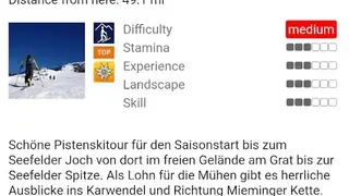
You can use the maps in any area within Austria, Germany, and South Tyrolean Alpine regions to check the current location and for orientation during tours. Mountainous regions do not provide sufficient cell coverage, which is why it is a good idea to download topographical maps for offline usage. The main highlight of the app is its expanding database of tours. You can explore and choose from over a thousand bike, ski, walking, and Alpine tours and discover Ferrata along the journey. Other features include Alphabetical listing, ranking based on tour value, filtering by sport, and more.