Nearmap alternatives
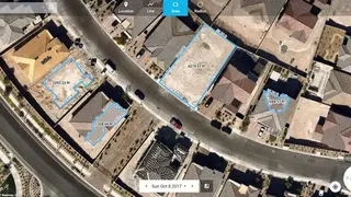
Nearmap is a technological Aerial map providing service software that enables you to make informed decisions and measurements. The software platform is all about inspecting and analyzing locations from everywhere, which then can turn a high-definition aerial map into a robust project management tool. There are multiple features on offer that are instant understanding, detailed change analysis, comprehensive imagery coverage, consistent clarity, cloud-based approach, discovery tools, and more.
Nearmap is showing its versatility with 3d aspects that are significantly easy to use and up-to-date, providing you the best-in-class aerial imagery. You have the insight that will allow you to take a competitive edge with data, and no one will see it.
The software surfaces the real-time browser experience for you, and you will have the maximum coverage, just select the location you want and export for the standard workflows. Furthermore, Nearmap is an affordable choice for your organization and enterprise having a single subscription, professional implementation, and more importantly, you have ways to cut costs and reduce risks.