Home Development Education & Reference

Enghouse NetDesigner alternatives
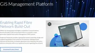
Enghouse NetDesigner is a geographic information system (GIS) and a spatial information system that allows you to visualize assets. These applications allow users to write, share and visualize their thoughts on the map. It is a program that uses both a graphical interface and technologies of programming layers. The program uses geospatial data and metadata concepts. Using these two key elements allows you to organize information in space and time, build logic systems, and display information in real-time on mobile devices, tablets, and desktops.
Enghouse NetDesigner is based on a powerful object-oriented SQL database and uses a multi-user approach to creating maps and spatial data. The tool is specifically designed to provide multiple users with simultaneous access to data. It is a great solution if you want to manage, access, share and visualize your data from multiple locations. Integration with other Enghouse tools means that you can create, change and manage maps with the same tools that you use for network design. Using this tool, you can view and analyze your network designs as well as integrate them into 3D models of buildings, sites, or landscapes.